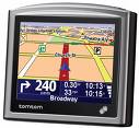
Download All UK Mosques as a POI file

| Click the image and chose your navigator model to download the appropriate file. Save it to your navigator memory along with this mosque image. |
Garmin users - you have the option of a file that contains richer information. Upload this file and this mosque image to your Garmin with POI Loader.
Key
The above downloads show various bits of information about a masjid in as few characters as possible. Below is a key to this information. We suggest you print this page out and keep it with your GPS device.A masjid is shown as: [Information]Name where information will have the following, if known:
- Capacity
- Women facilities - W (Women's facilities available) or NoW (No Women's facilities available)
- Usage (if not full time mosque) - J (Used for Jumu'ah only), NJ (No Jumu'ah held here. May be held nearby), Irreg (Not open for all 5 prayers)
- multi - multi-faith prayer room or hired hall
- Theme - Arab (Arab mainstream), Deob (Deobandi), Maud (Maudoodi), Salf (Salafi), Shia, Brel (Bareilvi), Sufi (Sufi, exc. Bareilvi). See the notes for more information about these.
- Management - Arab, Bang (Bangladeshi), Guje (Gujerati), Paki (Pakistani), Stud (Students), Tami (Tamil), Turk (Turkish). See the notes for more information about these.
Here is an example:
*[?600NoWBrel]Seven Kings Mosque, Muslim Education Trust
This is a Bareilvi-themed masjid with a capacity of 600 with no women's facility. Its location is precise, but some of the information (name, capacity etc) may be innaccurate.